3D GIS mapping & modelling in Faridabad
C & G Survey Technical Services is a trusted name in 3D GIS mapping & modelling in Faridabad, offering accurate, data-driven solutions for various industries. Our expertise helps in visualizing geographical information with precision, enhancing the way projects are planned, executed, and maintained. Whether for smart city development, government planning, or infrastructure projects, our GIS solutions transform raw data into actionable insights.
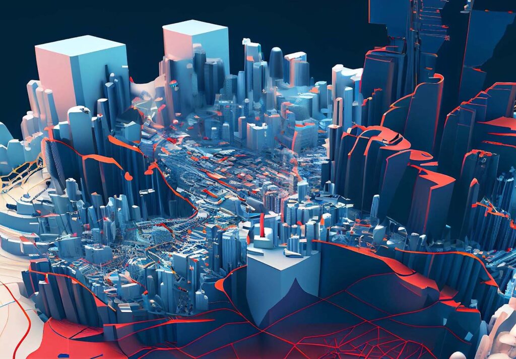
What is 3D GIS Mapping & Modelling?
3D GIS mapping and modelling combine geographic information with advanced visualization tools. It helps users understand the spatial relationship between objects, terrain, and infrastructure. By converting two-dimensional maps into three-dimensional models, we enable better planning and analysis. This technology is especially useful for urban development, environmental studies, and infrastructure management in Faridabad.
Why Choose C & G Survey Technical Services?
C & G Survey Technical Services stands out as a professional and reliable provider of GIS mapping in Faridabad. Our team of experts uses cutting-edge software and modern surveying equipment to deliver precise and comprehensive mapping solutions. We focus on quality, speed, and cost-effectiveness, ensuring that our clients get the best value for their investment.
Our key strengths include:
-
Highly accurate GIS mapping and 3D modelling
-
Skilled professionals with years of field experience
-
Timely project completion and customized solutions
-
Transparent pricing with no hidden costs
GIS Mapping for Smart City Projects in Faridabad
With Faridabad emerging as a smart city, GIS technology plays a vital role in its planning and execution. Our GIS mapping for smart city projects in Faridabad supports efficient management of urban infrastructure, utilities, and public services. It assists local authorities in data integration, city monitoring, and decision-making for sustainable development.
By using 3D GIS models, city planners can visualize roads, drainage systems, buildings, and green spaces in real-time. This helps in identifying potential issues before implementation, reducing costly errors and rework.
GIS Mapping for Government Projects in Faridabad
Government organizations rely on accurate data for better governance and planning. C & G Survey Technical Services provides GIS mapping for government projects in Faridabad, covering sectors like land records, transportation, disaster management, and public utilities.
Our GIS mapping solutions help:
-
Streamline land administration
-
Monitor development projects efficiently
-
Improve disaster response and resource management
-
Facilitate digital governance initiatives
With advanced tools, we ensure government departments receive reliable geospatial data to make informed policy decisions.
GIS Mapping for Infrastructure & Road Projects in Faridabad
Infrastructure development requires precise geographical insights. Our GIS mapping for infrastructure & road projects in Faridabad ensures that engineers and developers have accurate spatial data for planning roads, bridges, and pipelines.
We provide:
-
Topographic and cadastral mapping
-
Road network analysis
-
Utility mapping for power, water, and gas lines
-
Real-time progress monitoring
Using 3D GIS modelling, our experts deliver detailed layouts and visualizations that optimize construction, reduce risks, and enhance safety.
Benefits of 3D GIS Mapping & Modelling
Adopting 3D GIS mapping brings numerous advantages to organizations and planners:
-
Improved visualization: Clear understanding of spatial relationships and structures.
-
Better decision-making: Data-driven insights lead to smarter planning.
-
Cost savings: Minimizes project delays and reduces resource wastage.
-
Enhanced collaboration: Easy data sharing among stakeholders.
-
Future-ready technology: Supports sustainable urban growth and digital transformation.
Detailed Pricing Guide for GIS Mapping in Faridabad
C & G Survey Technical Services provides a transparent pricing model based on project size, data complexity, and required deliverables.
Here’s an approximate breakdown:
-
Basic 2D GIS Mapping: ₹5,000 – ₹10,000 per sq. km
-
3D GIS Mapping & Modelling: ₹10,000 – ₹25,000 per sq. km
-
Infrastructure & Utility Mapping: ₹15,000 – ₹30,000 per sq. km
-
Smart City & Government Projects: Customized pricing based on requirements
We also offer comprehensive GIS packages for long-term projects at discounted rates. Contact our team to receive a detailed quotation tailored to your specific needs.
Industries We Serve
Our GIS mapping and 3D modelling services cater to multiple sectors, including:
-
Smart Cities and Urban Planning
-
Transportation and Road Infrastructure
-
Real Estate and Property Management
-
Power and Utilities
-
Water Resources and Drainage Systems
-
Environmental and Land Management
C & G Survey Technical Services is dedicated to supporting every client with innovative mapping solutions that drive efficiency and growth.
Why Faridabad Prefers C & G Survey Technical Services
Faridabad’s rapid development demands precision and modern technology. Businesses and government agencies prefer us because we combine experience, innovation, and reliability. Our GIS mapping services empower clients to analyze data, forecast trends, and execute projects successfully.
We believe in long-term relationships, continuous innovation, and maintaining the highest professional standards.
Conclusion
C & G Survey Technical Services is your trusted partner for 3D GIS mapping & modelling in Faridabad. From smart city planning to infrastructure and government projects, our mapping solutions deliver accuracy, innovation, and efficiency. With detailed pricing options and expert support, we make GIS mapping simple and affordable.