Drone Survey Company in Delhi
C & G Survey Technical Services is a reputable drone survey company in Delhi that provides accurate, reliable, and reasonably priced aerial data solutions for a variety of industries in the quickly changing field of geospatial technology. We offer thorough drone-based surveying and mapping services throughout Delhi NCR with a strong emphasis on innovation, precision, and professionalism, making sure that our clients get the best insights possible to support their projects.
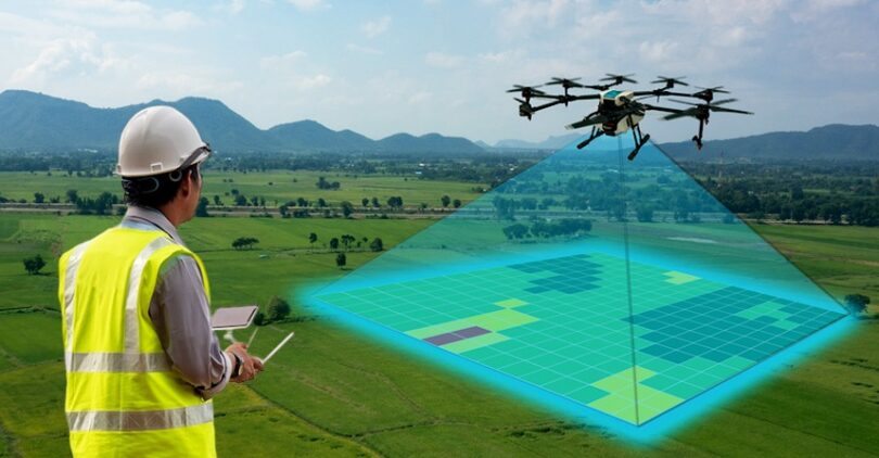
Whether it’s land surveying in East Delhi, topographic mapping in South Delhi, or LiDAR-based drone surveys in North Delhi, our skilled team and advanced UAV technology help businesses, architects, and engineers make data-driven decisions quickly and efficiently.
Why Choose a C & G Survey Technical Services?
At C & G Survey Technical Services, we go beyond traditional survey methods by using the latest drone technology and high-resolution sensors. Our drone services are designed to offer speed, accuracy, and safety, making us one of the most reliable drone survey companies in Delhi.
Here’s what makes us the preferred choice for clients across Delhi NCR:
-
High-precision aerial mapping and 3D modeling
-
Cost-effective drone survey solutions tailored to your project
-
Real-time data processing and analytics
-
Licensed drone pilots and certified professionals
-
Coverage across all zones of Delhi—North, South, East, and West
-
Fast turnaround time without compromising data quality
Our mission is to simplify the surveying process using cutting-edge drone technology that delivers accurate and actionable insights in a fraction of the time required by conventional methods.
Drone Survey Services We Offer
As a top drone survey company in Delhi, C & G Survey Technical Services offers a wide range of specialized drone surveying and mapping solutions to meet the diverse needs of our clients.
1. Drone Land Surveying in East Delhi
Our drone land surveying in East Delhi provides detailed aerial data for land development, construction planning, and property mapping. We gather real-time data using GPS-enabled drones and high-resolution aerial imagery to aid government organizations, developers, and architects in making better plans.
Key benefits include:
-
Accurate land measurements and boundaries
-
Rapid data acquisition for large areas
-
Reduced manpower and fieldwork time
-
Ideal for real estate, urban planning, and land records
Whether you’re planning infrastructure projects, commercial developments, or agricultural land assessments, our drone land surveying in East Delhi delivers precision you can trust.
2. Drone Topographic Survey in South Delhi
Topographic surveys are vital for understanding terrain elevation, contours, and natural features. Our drone topographic survey in South Delhi combines drone photogrammetry with 3D modeling to generate highly detailed and accurate topographic maps.
We use advanced drones equipped with GPS sensors and photogrammetry software to capture data for construction, road planning, mining, and environmental studies.
Advantages of drone topographic surveys:
-
Faster data collection compared to ground surveys
-
High-resolution elevation models and contour mapping
-
Ideal for infrastructure and civil engineering projects
-
Cost-effective and safe data acquisition
From hilly terrains to dense urban landscapes, our drone topographic survey in South Delhi ensures that no detail is overlooked.
3. LiDAR Drone Survey in North Delhi
When it comes to high-accuracy mapping, LiDAR (Light Detection and Ranging) technology is a game-changer. Our LiDAR drone survey in North Delhi uses advanced laser scanning systems to capture detailed 3D point cloud data of surfaces, structures, and landscapes.
Applications of LiDAR drone surveys:
-
Infrastructure and utility mapping
-
Forestry and vegetation analysis
-
Flood risk and drainage modeling
-
Mining and volume calculation
-
Archaeological site mapping
The LiDAR drone survey in North Delhi provided by C & G Survey Technical Services enables clients to access millimeter-level precision data for even the most complex terrains, saving time and ensuring accuracy in every project.
4. Affordable Drone Survey Cost in West Delhi
Budget often plays a crucial role in project planning, and we understand that. That’s why our drone survey cost in West Delhi is designed to be affordable without compromising on data quality.
We offer flexible pricing options depending on:
-
Project area size
-
Survey type (topographic, LiDAR, volumetric, etc.)
-
Data resolution required
-
Deliverable formats and turnaround time
Whether it’s a small construction site or a large industrial mapping project, we provide transparent pricing and customized packages to meet your specific needs.
Clients across West Delhi choose us for our cost-effective and efficient solutions that deliver premium results at competitive rates.
5. Best Drone for Surveying Delhi NCR
At C & G Survey Technical Services, we use only the best drones for surveying in Delhi NCR, equipped with advanced sensors and imaging systems for ultimate precision.
Our fleet includes:
-
RTK/PPK Drones for centimeter-level accuracy
-
LiDAR-equipped UAVs for dense terrain mapping
-
High-resolution camera drones for 2D and 3D mapping
-
Thermal and multispectral drones for environmental monitoring
Each drone is carefully selected and maintained to deliver consistent performance across various project types — from construction to agriculture, from mining to road development.
By integrating technology like GPS, IMU, LiDAR, and photogrammetry, we ensure accurate and reliable survey data across every corner of Delhi NCR.
Industries We Serve
Our drone survey solutions are designed for a wide range of industries, helping professionals across sectors make smarter, faster, and data-backed decisions.
1. Construction & Infrastructure
Drone surveys assist engineers and contractors in monitoring construction progress, ensuring design accuracy, and improving site management efficiency.
2. Real Estate & Urban Planning
Developers use drone mapping for layout design, boundary marking, and progress tracking in residential and commercial projects.
3. Agriculture & Irrigation
Farmers and agronomists benefit from precision mapping for crop health monitoring, irrigation planning, and land use management.
4. Mining & Quarrying
Accurate volumetric analysis, slope stability assessment, and pit monitoring are achieved through our drone-based surveys.
5. Environmental & Forestry
We assist in vegetation mapping, erosion studies, and ecological assessments using aerial drone imagery and LiDAR scanning.
6. Power & Utilities
Drone inspection and mapping services help maintain safety, identify faults, and plan new installations for transmission lines and pipelines.
How Drone Surveys Improve Accuracy and Efficiency
Traditional land drone surveys often take days or weeks to collect data manually. Drone technology revolutionizes this process by providing high-precision data in just hours.
Key Advantages of Drone Surveys:
-
Speed: Data collection is up to 80% faster than traditional methods.
-
Safety: Access hard-to-reach or hazardous areas without risk to personnel.
-
Accuracy: Achieve centimeter-level precision with RTK/PPK drones.
-
Visualization: Generate 3D models, orthomosaics, and contour maps for better analysis.
-
Cost-effectiveness: Reduced manpower and equipment costs lower overall survey expenses.
At C & G Survey Technical Services, we combine these benefits with expert analysis to deliver detailed, reliable results that empower decision-makers across industries.
Our Process – From Flight to Insight
Our drone surveying process is designed for accuracy, efficiency, and transparency.
-
Project Planning:
We assess the project area, requirements, and deliverables to plan the flight path and drone setup. -
Drone Data Capture:
Using advanced UAVs, we capture high-resolution aerial images, videos, or LiDAR data across the project site. -
Data Processing:
Collected data is processed using GIS and photogrammetry software to create accurate 2D maps, 3D models, or contour layouts. -
Analysis & Reporting:
Our experts analyze the processed data and prepare a detailed report customized to your project needs. -
Delivery & Support:
We deliver the final output in your preferred format (AutoCAD, GIS, PDF, etc.) and offer post-survey support if required.
This streamlined workflow ensures you receive fast, reliable, and high-quality results — every time.
Why Delhi Chooses C & G Survey Technical Services
Delhi, with its fast-growing infrastructure and urban development projects, demands advanced survey solutions. C & G Survey Technical Services fulfills that demand by providing comprehensive drone surveying across all regions — North, South, East, and West Delhi.
-
West Delhi: Affordable drone survey cost for construction and land mapping projects.
-
East Delhi: Precision drone land surveying for real estate and urban planning.
-
South Delhi: Detailed topographic surveys for civil and infrastructure projects.
-
North Delhi: Advanced LiDAR drone surveys for 3D terrain and vegetation mapping.
-
Delhi NCR: Reliable service using the best drones for surveying, ensuring data accuracy and project efficiency.
Conclusion
In a world where accuracy, speed, and data integrity are key to successful project execution, C & G Survey Technical Services continues to lead as a top-rated drone survey company in Delhi. With our expertise in land surveying, topographic mapping, and LiDAR drone scanning, we help our clients achieve precision-driven results at competitive costs.