Drone Survey Company in Noida
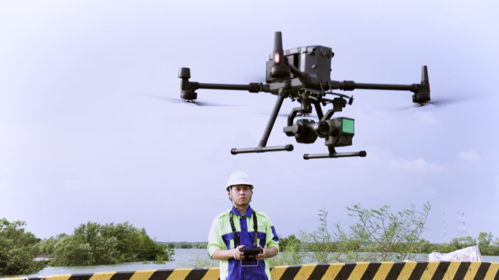
In today’s fast-paced world of technology and innovation, accuracy and efficiency have become essential in every industry — from construction and real estate to agriculture and infrastructure. C & G Survey Technical Services, a trusted Drone Survey Company in Noida, drone surveying and mapping companies in Greater Noida stands as a pioneer in providing cutting-edge aerial survey and mapping solutions powered by advanced survey technology. With a team of skilled professionals and state-of-the-art drones like DJI and Wingtra, we deliver precise data for mapping, inspection, and analysis that transform the way projects are planned and executed.
About C & G Survey Technical Services
Founded with a vision to revolutionize the geospatial and surveying industry, C & G Survey Technical Services is one of the most reliable drone surveying and mapping companies in Greater Noida. We specialize in aerial data collection, 3D mapping, volumetric analysis, and land surveying using advanced UAV (Unmanned Aerial Vehicle) technologies.
Our mission is simple — to provide high-quality, cost-effective, and accurate drone survey solutions that help businesses make better decisions, save time, and reduce operational costs.
Whether you’re looking for a Drone Survey Near Me for your construction site, infrastructure project, or real estate development, our team of professionals ensures you receive comprehensive and precise aerial insights.
Why Choose C & G Survey Technical Services?
Choosing the right Drone Survey Company in Noida can make all the difference in project accuracy and efficiency. Here’s why clients across sectors trust C & G Survey Technical Services:
1. Experienced and Certified Team
Our team comprises certified drone pilots, GIS experts, and surveying engineers with years of field experience. Their expertise ensures every project is conducted safely, efficiently, and in compliance with DGCA (Directorate General of Civil Aviation) guidelines.
2. Advanced Drone Technology
We use high-end drones such as DJI and Wingtra — globally recognized for their precision, stability, and data accuracy. The Wingtra drone in Noida is particularly effective for large-scale topographic and volumetric mapping, while DJI drones excel in detailed aerial photography and inspection.
3. Comprehensive Drone Surveying and Mapping
From drone surveying and mapping in Greater Noida to high-resolution orthomosaic generation, we provide complete aerial data solutions that eliminate guesswork and provide actionable insights.
4. Unmatched Accuracy and Speed
Our drone-based surveys provide centimeter-level accuracy in a fraction of the time traditional surveying methods take. Whether it’s contour mapping, boundary demarcation, or volumetric measurement, accuracy is our top priority.
5. Custom Solutions for Every Industry
We understand that every project is unique. That’s why C & G Survey Technical Services tailors drone survey solutions to meet your specific industry requirements — whether it’s construction, real estate, mining, or agriculture.
Our Drone Surveying Services in Noida
As the top-rated Drone Survey Company in Noida, we offer a diverse range of drone-based services, each designed to deliver precise data and enhance project efficiency.
1. Land and Topographic Surveying
Our land surveys provide detailed 3D terrain data essential for infrastructure design, planning, and project development. Using DJI drone surveys in Noida, we deliver high-accuracy contour maps, elevation models, and orthophotos.
2. Drone Mapping and GIS Integration
We specialize in drone surveying and mapping in Greater Noida that integrates seamlessly with GIS (Geographic Information Systems). This integration helps in accurate spatial analysis, boundary mapping, and georeferenced data visualization.
3. Construction Site Monitoring
Drone technology offers a safe, efficient, and real-time solution to monitor large construction sites. Our drone surveys capture progress, assess material stock, and help identify discrepancies, ensuring your project stays on track.
4. Mining and Quarry Survey
Volumetric measurement in mining has become simpler and more accurate with drone technology. Using the Wingtra drone in Noida, we measure stockpile volumes and pit dimensions with precision — helping mining companies optimize their resources.
5. Real Estate and Urban Planning
Our drone mapping services help real estate developers and architects create 3D models and aerial views that aid in project visualization and urban development planning.
6. Powerline, Pipeline, and Infrastructure Inspection
Using DJI drones, we conduct detailed inspections of powerlines, solar farms, and pipelines — minimizing manual risk and providing high-resolution imagery for maintenance and safety checks.
7. Agriculture and Environmental Monitoring
Drones play a crucial role in modern agriculture. With our Drone Survey Near Me, farmers and environmental researchers can monitor crop health, soil conditions, and water management effectively.
8. Road and Railway Corridor Mapping
We provide detailed mapping of road and rail corridors, enabling engineers to plan, design, and maintain infrastructure efficiently.
Benefits of Drone Surveying Over Traditional Methods
Modern drone surveying has transformed data collection across industries. Here’s why more businesses prefer drone mapping companies in Greater Noida like C & G Survey Technical Services:
-
Faster Data Collection: Complete large-scale surveys in hours instead of days.
-
High Accuracy: Drones capture centimeter-level precision for maps and models.
-
Cost-Effective: Save up to 50% compared to traditional ground surveying methods.
-
Safety and Accessibility: Easily survey hazardous or inaccessible areas without risk.
-
3D Modeling and Visualization: Generate high-resolution 3D data for better project insights.
-
Data Integration: Seamlessly integrate survey results with CAD and GIS platforms.
Technology We Use – DJI and Wingtra Drones
At C & G Survey Technical Services, we believe in using only the best technology.
DJI Drone Survey in Noida
DJI drones are globally trusted for their reliability and image quality. Our DJI drone survey in Noida delivers sharp, detailed imagery ideal for construction, real estate, and industrial inspections. These drones ensure stable flight performance and accurate data capture, even under challenging conditions.
Wingtra Drone in Noida
The Wingtra drone is a vertical take-off and landing (VTOL) drone designed for professional mapping. It’s ideal for large areas, offering unmatched coverage and precision. With the Wingtra drone in Noida, we can complete large-scale mapping projects quickly and efficiently — perfect for infrastructure and mining applications.
Why Drone Surveys Are the Future of Mapping
Traditional surveys often face challenges like human error, time consumption, and limited accessibility. Drone surveys eliminate these problems by offering:
-
Real-Time Data Collection
-
High-Resolution Imagery
-
Reduced Human Intervention
-
Precise 3D Modelling
-
Faster Turnaround Times
As a result, organizations in Noida and Greater Noida are increasingly adopting drone technology for accurate, efficient, and safe surveying solutions.
Commitment to Quality and Safety
We take safety and data quality seriously. Our operations follow strict DGCA regulations, ensuring all flights are conducted within legal and ethical frameworks. Each survey project undergoes multiple quality checks to ensure data accuracy and reliability.
We also prioritize client confidentiality — all aerial data collected remains secure and accessible only to authorized project stakeholders.
Client-Centric Approach
At C & G Survey Technical Services, we believe in building long-term relationships through trust and performance. Our commitment to client satisfaction drives us to deliver excellence in every project. From the initial consultation to the final data delivery, we ensure transparent communication, on-time execution, and measurable results.
Contact C & G Survey Technical Services Today
Looking for the most reliable Drone Survey Company in Noida?
C & G Survey Technical Services is here to help you with professional, precise, and cost-effective survey solutions whether you need drone surveying and mapping in Greater Noida, DJI drone survey in Noida, or advanced Wingtra drone mapping, we have you covered.