Aerial LiDAR scanning in Faridabad
C & G Survey Technical Services delivers precise, efficient, and reliable Aerial LiDAR scanning in Faridabad for modern infrastructure development. The company combines advanced technology with expert survey techniques. As a result, clients receive accurate mapping solutions for land, construction, and road projects. The team focuses on delivering high-quality survey outputs that support planning, engineering, and execution.
What Makes Us a Top LiDAR Mapping Company in Faridabad
C & G Survey Technical Services stands out due to its commitment to accuracy and innovation. The company uses high-performance sensors that capture ultra-detailed geographic data. Moreover, the survey team ensures reliable outputs even in challenging terrains. This combination of expertise and technology makes the company a top LiDAR mapping company in Faridabad.
Benefits of Aerial LiDAR Scanning in Faridabad
Aerial LiDAR has transformed the way mapping and surveying work. It offers rapid data collection, even in difficult locations. It also provides high-density point clouds that support detailed analysis. These benefits help engineers and planners complete projects with confidence and clarity.
High-Accuracy LiDAR Surveying Service in Faridabad
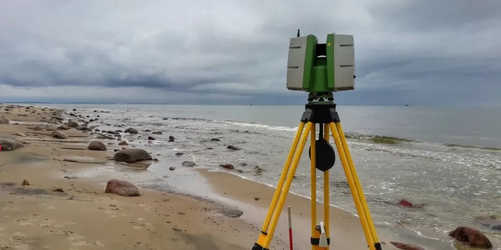
C & G Survey Technical Services offers a trusted LiDAR surveying service in Faridabad for both small and large-scale projects. The team uses airborne and drone-based LiDAR systems. These systems capture precise elevation data and terrain details. Because of this, clients can make faster and better decisions. The company maintains strict quality control to ensure every dataset meets industry standards.
Reliable LiDAR Mapping Company in Faridabad for All Projects
The company provides detailed LiDAR mapping services tailored to project needs. Its maps help clients visualize landscapes, utilities, and infrastructure. These maps support design, construction, and inspection activities across sectors. C & G Survey Technical Services remains a preferred LiDAR mapping company in Faridabad for developers and contractors.
LiDAR Land Development Survey in Faridabad
Land development requires accurate terrain evaluation and planning. The team offers LiDAR land development survey in Faridabad to support such needs. This survey identifies slopes, boundaries, elevations, and natural features. These insights help with zoning, layout design, and land utilization. The detailed survey reduces risks and improves decision-making throughout the development process.
Best LiDAR Survey for Road Projects in Faridabad
Road projects must rely on precise data for alignment and design. The company offers specialized LiDAR survey for road projects in Faridabad. These surveys capture corridor details, road widths, embankments, and surrounding structures. Since the data is highly accurate, engineers can design safe and efficient road networks. The rapid data collection also reduces project delays and helps maintain timelines.
How C & G Survey Technical Services Ensures Quality
The company follows a structured workflow to maintain accuracy. It begins with planning and defining project goals. Next, the team uses advanced airborne LiDAR equipment to collect data. After this, the data is processed using specialized software. Every step is monitored for precision and clarity. The final output includes detailed maps and reports ready for engineering use.
Why Choose C & G Survey Technical Services
There are many reasons clients prefer this company for LiDAR solutions. The team has strong technical skills and years of experience. They also use modern tools to deliver fast results. Furthermore, the company is committed to supporting infrastructure growth in Faridabad. With accurate data and professional service, clients achieve better project outcomes.
Applications of Aerial LiDAR Scanning in Faridabad
Aerial LiDAR supports multiple sectors. It is used in construction planning, road development, land analysis, and environmental studies. It is also essential for disaster management and monitoring natural changes. These applications help industries grow with confidence and efficiency.
Top LiDAR Mapping Company in Faridabad and Gurgaon
C & G Survey Technical Services serves clients not only in Faridabad but also in Gurgaon. The company provides complete LiDAR solutions across both cities. This makes it a trusted partner for infrastructure developers in NCR. Its strong presence ensures faster project support and regional expertise.
Advanced Technology Used by the Company
The company uses state-of-the-art sensors that capture thousands of data points per second. These sensors create precise digital elevation models. They also produce accurate topographic and contour maps. This technology ensures that clients receive dependable results every time.
How Aerial LiDAR Improves Project Efficiency
Aerial LiDAR reduces manual labour and field time. It also delivers results much faster than traditional surveying. With these advantages, teams can start planning sooner. This also helps reduce costs and avoid unexpected delays. The improved efficiency benefits contractors, engineers, and government agencies.
Safety and Environmental Advantages of LiDAR Surveys
Aerial LiDAR scanning reduces the need for physical ground surveys. This creates a safer working environment. It also avoids disturbing sensitive lands and habitats. Because of this, LiDAR is suitable for eco-sensitive zones where manual work is restricted.
Conclusion: Your Trusted Partner for LiDAR Services
C & G Survey Technical Services remains a leader in Aerial LiDAR scanning in Faridabad. The company delivers accurate, fast, and reliable mapping solutions. Whether it is land development, road construction, or urban planning, the team supports every stage with professional survey outputs. With its advanced capabilities, it continues to be one of the top LiDAR mapping companies in Faridabad and Gurgaon.