Construction site land survey in gurgaon
C & G Survey Technical Services is a trusted name in construction site land survey in Gurgaon, delivering reliable and precise mapping solutions. With advanced technology, experienced professionals, and a strong commitment to accuracy, the company provides comprehensive land survey services for construction, agriculture, and boundary resolution needs.
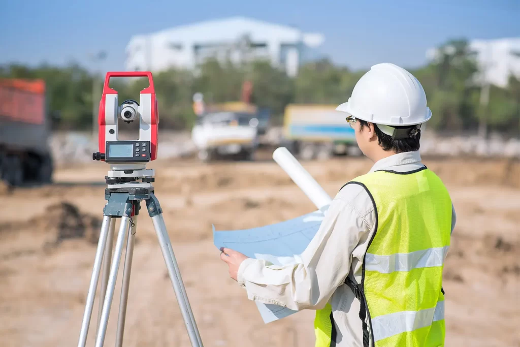
Reliable Construction Site Land Survey in Gurgaon
C & G Survey Technical Services specializes in construction site land survey in Gurgaon, helping developers, architects, and contractors plan with confidence. Accurate topographic and boundary mapping ensures smooth project execution from the foundation stage to final completion.
The expert team uses high-precision equipment like total stations, GPS systems, and drones to collect detailed land data. This eliminates errors and saves time during construction planning and design.
Every project begins with a detailed site analysis, ensuring that no corner is left unchecked. From elevation measurement to slope detection, C & G Survey Technical Services guarantees data accuracy for every inch of your land.
Why Land Surveying is Crucial for Construction Projects
A professional construction site land survey lays the foundation for a safe and efficient building process. It identifies property boundaries, detects potential obstacles, and ensures compliance with regulatory standards. Without proper land mapping, developers risk boundary disputes and costly errors.
C & G Survey Technical Services delivers surveys that align with legal requirements, ensuring peace of mind for clients across Gurgaon. Their experienced engineers create clear, detailed reports that simplify decision-making for all stakeholders.
Comprehensive Agricultural Land Mapping in Gurgaon
Beyond construction, the company offers agricultural land mapping in Gurgaon for farmers, landowners, and agribusinesses. Accurate mapping helps assess soil health, irrigation patterns, and land utilization, leading to better crop management and productivity.
Using satellite imagery and drone-based survey tools, C & G Survey Technical Services provides real-time agricultural data. This empowers clients to make informed decisions and improve land efficiency.
Whether it’s identifying uneven terrains or measuring large farmlands, the team ensures precise mapping that benefits both small and large-scale agricultural projects.
Resolving Boundary Disputes with Precision Surveys
Land boundaries often cause conflicts among neighbors or stakeholders. The boundary dispute land survey in Gurgaon service by C & G Survey Technical Services provides factual evidence that resolves such issues quickly.
The company conducts boundary verification using historical land records, GPS coordinates, and modern survey instruments. This ensures accurate demarcation and eliminates confusion over property lines.
Clients receive certified survey maps and legal documents to support their case in property disputes or registration processes.
Advanced Technology for Modern Land Surveys
C & G Survey Technical Services adopts cutting-edge technology to enhance the precision and efficiency of every project. Their equipment includes total stations, GPS surveying tools, and drone mapping systems.
This combination allows the team to collect high-quality geospatial data for large-scale and complex areas. The use of drones significantly reduces survey time while increasing accuracy.
By integrating digital mapping software, the company delivers detailed 2D and 3D survey reports, giving clients a complete visual understanding of their land.
Experienced Professionals and Transparent Process
With years of expertise, the engineers and surveyors at C & G Survey Technical Services understand the importance of data integrity. Their systematic approach ensures every project meets deadlines without compromising quality.
The process begins with site inspection, followed by data collection, analysis, and final reporting. Clients are kept informed throughout the survey process for complete transparency.
This professional approach has earned C & G Survey Technical Services a strong reputation among real estate developers, government agencies, and private landowners in Gurgaon.
Benefits of Choosing C & G Survey Technical Services
-
Accurate and legally verified survey reports
-
Use of advanced GPS and drone technology
-
Expert team with years of field experience
-
Fast turnaround time for projects
-
Cost-effective and transparent pricing
-
Comprehensive reports for construction, agriculture, and boundary cases
-
Compliance with national surveying standards
-
Excellent customer support and consultation services
These advantages make C & G Survey Technical Services a preferred choice for all land survey needs in Gurgaon and nearby areas.
Committed to Accuracy and Client Satisfaction
Accuracy is the foundation of every successful survey. C & G Survey Technical Services takes pride in offering dependable data that supports better planning and dispute-free development. The team focuses on client satisfaction through consistent performance, reliability, and clear communication.
Their commitment extends beyond delivering reports — they ensure that clients fully understand the results and implications of each survey. This customer-first approach helps in building long-term trust and partnerships.
Serving Multiple Sectors Across Gurgaon
The company’s expertise covers multiple sectors, including:
-
Real estate and construction projects
-
Agriculture and farm management
-
Industrial development planning
-
Infrastructure and road construction
-
Property registration and documentation support
By offering end-to-end land survey solutions, C & G Survey Technical Services plays a crucial role in Gurgaon’s growth and urban development.
Conclusion
C & G Survey Technical Services stands as a leading provider of construction site land survey in Gurgaon, offering unmatched expertise and precision. From agricultural land mapping to boundary dispute land surveys, the company ensures reliable, data-driven results that empower clients to make confident decisions.