Accurate Terrain Mapping for Smarter Planning and Design
Every successful construction and infrastructure project begins with a clear understanding of the land. Slopes, elevations, natural features, and existing structures all influence how a site can be developed. Topographic Survey Services provide this critical information by accurately mapping the physical features of a site.
At C&G Survey Technical Services, we deliver precise and reliable topographic surveys that support smart planning, efficient design, and risk-free execution for projects of every scale.
What Is a Topographic Survey?
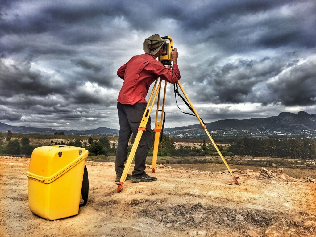
A topographic survey measures and maps both natural and man-made features of land, including elevations, contours, drainage patterns, roads, buildings, trees, and utilities. Unlike basic boundary surveys, topographic surveys provide detailed three-dimensional data that helps engineers, architects, and planners understand how the land behaves and how best to use it.
These surveys are essential for site planning, grading design, drainage solutions, and infrastructure development.
Why Topographic Surveys Are Important?
Topographic surveys play a crucial role in reducing design errors, controlling construction costs, and ensuring long-term project success. They help professionals:
- Understand site elevations and slopes
- Plan effective drainage and earthwork
- Identify existing structures and constraints
- Design safe and efficient layouts
- Avoid costly modifications during construction
Accurate topographic data ensures that projects are built on solid planning, not assumptions
Our Topographic Survey Services
1. Detailed Site Mapping
We provide high-resolution mapping of land features, capturing accurate elevation data, contours, and site details essential for planning and design.
2. Construction & Infrastructure Surveys
Our topographic surveys support roads, highways, industrial facilities, and large infrastructure projects by delivering dependable terrain data.
3. Land Development & Real Estate Surveys
For residential and commercial developments, we help developers assess land feasibility, optimize layouts, and meet regulatory requirements.
4. DGPS & Advanced Survey Integration
By integrating DGPS technology, total stations, and modern survey methods, we ensure consistent accuracy across large and complex sites.
Technology-Driven Survey Solutions
At C&G Survey Technical Services, we combine experienced surveyors with modern equipment, including:
- DGPS and GNSS systems
- Total stations
- Drone-assisted mapping (where applicable)
- Advanced data processing and contour mapping software
This ensures faster execution, higher accuracy, and detailed deliverables tailored to project needs.
Why Choose C&G Survey Technical Services?
✔ Highly accurate and reliable topographic data
✔ Experienced and skilled survey professionals
✔ Advanced equipment and proven methodologies
✔ Suitable for small sites and large infrastructure projects
✔ Timely delivery and professional reporting
Our focus is to deliver terrain data that engineers and planners can trust.
Industries We Serve
- Real Estate & Land Development
- Infrastructure & National Highways
- Industrial & Commercial Projects
- Construction & Engineering Firms
- Government & Public Sector Projects
No matter the project size or complexity, our topographic survey services provide the accuracy required for confident decision-making.
Mapping the Land. Shaping the Future.
At C&G Survey Technical Services, we believe accurate land data is the foundation of smart development. Our Topographic Survey Services transform terrain information into actionable insights that help clients build efficiently, safely, and sustainably.
Built in Bharat. Built for Bharat. Ready for the world. 🇮🇳
📞 Contact Us: +91-7678543120
🌐 Visit: www.candgsurvey.in